fbpx

News & Announcements


Plan Your Trip

Winter Weather Storm Advisories January 2022

8 P.M. UPDATE – Service Advisory No.4|

Lanes have reopened on the Ravenel Bridge and routes are returning to regular schedules. Riders should check back periodically for updates on potential route disruptions if ice issues occur as temperatures rise during the day on Sunday (1.23.22).

Service Advisory No.4| Saturday, Jan. 22nd, 6:00 p.m.

All Northbound lanes of the Ravenel Bridge and the 2 inside Southbound lanes are currently closed to traffic due to falling ice from the suspension cables. In order to be as efficient as possible to transport our passengers around Mt. Pleasant and to Downtown while the bridge is closed routes 30/40 and 41 will run as follows:

  • Rt. 41 will run only in Mt. Pleasant on a detour until the bridge reopens.  It will also stop at Towne Center as a transfer point to the Rt. 40 vehicles that will be traveling downtown.
  • Rt. 30/40 has three vehicles dedicated to it.  One bus will circulate as Route 30 only. Using Towne Center as a transfer point, passengers can transfer from Rt. 41 to the other two Rt. 40 buses that will travel back and forth to the Downtown area via I526 until the bridge reopens.

Expect some delays on these routes until the bridge has reopened and service returns to normal.

Service Advisory No.3 | Friday, Jan. 21st, 1:00 p.m.

As inclement weather conditions progress, service may start late, end early, or be suspended if roads and/or bridges close and it becomes unsafe to continue operations.

Current service impacts:

  • All Express service and Route 203 will start 1 hour early this afternoon
  • All Express service will end 1 hour early this evening
  • Route 203 -The last trip from Jonathan Lucas will be at 8:30 p.m.
  • All other fixed-routes expected to run as regularly scheduled throughout the day as long as conditions permit
  • Expect potential service disruptions and possible service suspension for routes running after 7 p.m.
  • Saturday (Delayed start) – All routes expected to start running at 10 a.m. pending weather and road conditions.

Staff continues to closely monitor weather and road conditions on Friday and Saturday.  Conditions could change very rapidly and riders are encouraged to take any necessary trips earlier today before condition deteriorate and check RideCARTA.com periodically for service updates.

Service Advisory No.2 Thursday, Jan. 20th 7:00 p.m.

All Express service and Route 203 will start 1 hour earlier tomorrow due to early closures and inclement weather. 

At this time, all other CARTA fixed- route services are scheduled to run as regularly scheduled on Friday and Saturday.  However, conditions could change very rapidly and riders should be prepared to check RideCARTA.com periodically for service updates.

As inclement weather conditions progress, service may start late, end early, or be suspended if roads and/or bridges close and it becomes unsafe to continue operations.

Service delays, detours or suspension notifications will be sent via the following channels:

  • RideCARTA.com
  • Social Media: Facebook: @rideCARTA, Twitter: @rideCARTA @CARTA_Alerts)
  • The “Transit” app: Riders are encouraged to download the app for service change notifications     
  • Announcements will also be provided to local media 

Staff will continue to closely monitor reports and conditions on Friday and Saturday to determine if additional service modifications are required.

Service Advisory No.1 Thursday, Jan. 20th 4:00 p.m.

At this time, all CARTA fixed- route services are scheduled to run as regularly scheduled on Friday and Saturday.

However, conditions could change very rapidly and riders should be prepared to check RideCARTA.com periodically for service updates.

As inclement weather conditions progress, service may start late, end early, or be suspended if roads and/or bridges close and it becomes unsafe to continue operations.

Service delays, detours or suspension notifications will be sent via the following channels:

  • RideCARTA.com
  • Social Media: Facebook: @rideCARTA, Twitter: @rideCARTA @CARTA_Alerts)
  • The “Transit” app: Riders are encouraged to download the app for service change notifications     
  • Announcements will also be provided to local media 

Staff will be closely monitoring reports throughout the day as well as conditions on Friday and Saturday.  Transit operations are essential and any suspended service will be as brief as possible.

Route 32 NorthBridge Service changes – Effective 10.03.21

A Berkeley-Charleston-Dorchester Council of Governments Program

CARTA TO PROVIDE A SAFE AND FREE CONNECTION ACROSS THE NORTH BRIDGE FOR CYCLISTS AND PEDESTRIANS
ROUTE 32 SERVICE ACROSS BRIDGE WILL DOUBLE IN FREQUENCY

NORTH CHARLESTON (September 22, 2021) – The Charleston Area Regional Transportation Authority (CARTA) received unanimous board approval for enhancements to Route 32 aimed at bridging the gap for cyclists and pedestrians seeking to cross the North Bridge.

The new initiative will begin October 3, 2021, and will provide free transportation between bus stops on either side of the bridge for both cyclists and pedestrians. In addition, the policy change will allow bicycles on the bus from one side of the bridge to the other for free. In the event that bicycle racks are full, this change allows bicycles to be brought on board the bus in-between stops.

“CARTA is committed to connecting the region by providing safe and reliable transportation to anyone who needs it,” said CARTA Board of Directors Chairman Mike Seekings. “This new offering will help bridge the safety gap that currently exists so that everyone, regardless of socioeconomic ability will be able to safely cross the North Bridge.”

As part of the effort, the service frequency for Route 32 will be doubled, cutting wait times in half. The enhanced service will begin on October 3, 2021, to align with the new accommodations for cyclists and pedestrians, and will occur every half-hour Monday through Saturday, and every hour on Sunday.

Route 32 provides hourly connections between North Charleston and West Ashley via North Bridge, with major stops being the North Charleston Superstop, Ashley Landing Mall, and Citadel Mall. Currently, North Bridge has no pedestrian or cycling amenities.

Data from the South Carolina Department of Transportation from 2014-2017 identified nine pedestrian/bicycle – motor vehicle collisions on the bridge. A further three pedestrian/bicycle – motor vehicle fatalities have occurred since 2018. 

“Increasing the frequency of Route 32 and allowing bikes on the 32 bus as needed are important and appreciated steps toward a better, more accessible North Bridge crossing for all,” said Charleston Moves Executive Director Katie Zimmerman. “These improvements will offer more safe crossing opportunities to work, appointments, and visiting family.”                           

Efforts are underway to bring about needed structural changes to the bridge via the Better North Bridge project. The project is a collaborative effort between Charleston County, Berkeley-Charleston-Dorchester Council of Governments, and Charleston Moves with the goal to bring about a permanent, standalone bike and pedestrian crossing to provide a safe and equitable connection between North Charleston and West Ashley. The project is currently in the study phase.

Full route details and bus tracking will be available in the Transit App, which can be downloaded from the App Store and Google Play. Riders can also view traffic conditions and municipal information for all area beaches via the Beach Reach app, also available for Apple and Google.

ABOUT CARTA

The Charleston Area Regional Transportation Authority is a public transportation system dedicated to providing affordable transit in the Charleston community through local fixed routes, on-demand paratransit service and express commuter routes. For the latest on CARTA, visit ridecarta.com, like us on Facebook or follow on Twitter at @RideCARTA. All customers are encouraged to plan rides and track buses with the CARTA-endorsed Transit app.

###

MEDIA CONTACT
Daniel Monroe, Account Supervisor
Rawle Murdy Associates
(843) 422-0682
dmonroe@rawlemurdy.com

Route Improvements

Double the frequency – Wait time cut in half!

Starting Sunday, October 3rd the route will operate:
• Every 30 minutes Monday – Saturday
• Every hour on Sunday
Click Route 32 North Bridge 10.03.21 to view the new schedule times.

Safe Crossings – Ride for Free to cross NorthBridge

• Bicyclist and pedestrians ride CARTA FREE to cross the North Bridge/Cosgrove Bridge.
• Bicyclists: Bikes are allowed on the bus if bike racks are full and as space permits.
• To utilize, passengers will board the bus and exit at the stops listed below ONLY:
o Stop ID 173: Cosgrove/Mott Ave.
o Stop ID 174: Cosgrove/Mott Ave.
o Stop ID 695: Sam Rittenburg Blvd/Poston Rd.
o Stop ID 696: Sam Rittenburg Blvd/Poston Rd.

Bridge Run 2021-Service Impacts

Expect some route delays this week due to higher traffic volumes related to the Bridge Run on Saturday 09.25.21.
  • On Thursday, September 23rd and Friday September 24th due to increased traffic volumes related to the Bridge Run in the North Charleston near the Coliseum and Tanger Outlets as well as Downtown, all routes traveling in those areas can expect some possible delays.
  • All buses including Express buses will be running on regular schedule but may be affected by the high volumes of traffic.

 Route Service Day of Bridge Run – Saturday September 25, 2021

On Saturday, September 25th all routes that travel into the downtown area will be affected by road closures, detours and high volumes of traffic, expect possible delays.

  • DASH route 211 will not start until the race is completed.  DASH 210 and 213 will run on a detour.
  • Routes 10, 11, 20, 30, 31, 33, 40, and 41 will all have detours.  Click the link below to view all detours that will be in effect until service returns to regular service after the roads are reopened.

Mt. Pleasant Service:

In order to be as efficient as possible to transport our passengers around Mt. Pleasant and to Downtown while the bridge is closed during the Bridge Run, Routes 40 and 41 will run as follows on Saturday morning 9/25/21:

  • Rt. 40 has three vehicles dedicated to it.  One bus will circulate only in the Mt. Pleasant area.  Using Towne Center as a transfer point, passengers can transfer to the other two Rt. 40 buses that will travel back and forth to the Downtown area via I526 until the completion of the race.
  • Rt. 41 will run only in Mt. Pleasant on a detour until the race is completed.  It will also stop at Towne Center as a transfer point to the Rt. 40 that will be traveling downtown.

Expect some delays on these routes until the bridge has reopened and service returns to normal.

Riders are encouraged to use the transit app and/or the Text or Call for Next Bus (843-202-4410) features for real time route information. Customer service representatives can be reached at 843-724-7420 and will be available through the chat feature located here at ridecarta.com.

Click CARTA 2021 Bridge Run Service Impacts  to view detours and missing stops for Saturday service

Books on Buses: CCPL, CARTA Expand Free Book Program to Two More Bus Stops

The Books on Buses program aims to increase access to library services and encourage literacy throughout Charleston County 

CHARLESTON, S.C. – Public transportation riders in Charleston County will now have access to even more free books at additional bus stops. The Charleston County Public Library and The Charleston Area Regional Transportation Authority (CARTA) partnered to provide free books for all ages at CARTA bus stops through the Books on Buses program, which was launched in April at two bus stops in North Charleston. This week, two additional bus stops in West Ashley and downtown Charleston are being launched.  

The new “book boxes” are located in Charleston at the intersection of Ashley River Road and Magwood Drive (Stop #810) and at the intersection of Meeting Street and Mary Street (Stop #560). The program initially launched in April with two North Charleston CARTA stops at Rivers Avenue Park and Ride Lot at 1251 Melnick Drive and the Superstop at the intersection of Rivers and Cosgrove Avenues.

“We’ve given out hundreds of books since the Books on Buses program launched earlier this year,” said CCPL’s Outreach Manager Kathleen Montgomery. “This program allows us to further connect with our community and promote literacy in Charleston County.”

These boxes contain books for all ages from CCPL’s Community Collection, which uses donations and discarded materials to encourage literacy outside of library walls. The books are free and do not need to be returned to the box or any other library location.

“CARTA connects riders to the things they love, and thanks to this new chapter in our partnership with the Charleston County Public Library, that includes more books that open up new avenues of learning,” said CARTA Board of Directors Chairman Mike Seekings. “We are excited to expand the ‘books on buses’ partnership to new areas in Charleston County and look forward to helping our riders write their own success stories.”

“We are so happy that this program has been so well-received by the public and that we have been able to distribute almost 1,000 books into the community so far,” said CCPL Community Engagement Associate Director, Devon Andrews. “CCPL is committed to helping Charleston County residents have increased access to books and literacy wherever they are in their day and we are grateful to CARTA for their partnership on this project.”

For more information, visit ccpl.org, contact your local library branch, or connect with the library on Facebook, Twitter, or Instagram. For information on CARTA, visit ridecarta.com.

ABOUT CARTA

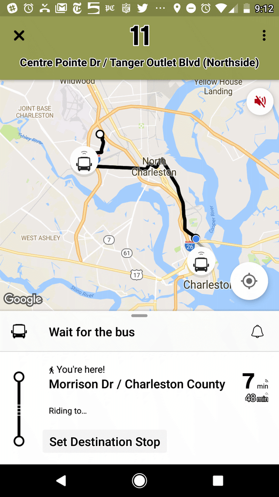
The Charleston Area Regional Transportation Authority (CARTA) is a public transportation system dedicated to providing affordable transit in the Charleston, S.C., community through local fixed routes, on-demand paratransit, and express commuter service. For the latest on CARTA, visit ridecarta.com, like us on Facebook or follow on Twitter at @RideCARTA. All customers are encouraged to plan rides and track buses with the CARTA-endorsed Transit app.

Stop location–Meeting at Mary
Stop location – Ashley River Road and Magwood Dr.
Stop location-Rivers Ave. Park and Ride 1251 Melnick Dr.
Stop location-Superstop Rivers and Cosgrove

Senior Free Ride Day-Saturday 08.21.21

August 21st is National Senior Citizens Day which was created to give back to seniors that have impacted our lives and to recognize the achievements of those who have already given so much.  The day provides an opportunity to show our appreciation for their dedication, accomplishments, and for all they have done and continue to do–we owe our seniors our thanks and gratitude.  Seniors 55 and older simply show your ID and ride all routes free on Saturday. This is the perfect opportunity to get some shopping done, visit friends or family or simply explore the city and our different routes.

The final Senior Free Ride day for 2021 will be on Saturday, December 11th. To learn more about this program click SeniorsFreeRide.

Notice of Public Hearing: Route 32

The public is hereby advised that a public hearing will be offered by the Charleston Area Regional Transportation Authority (CARTA) and the Berkeley-Charleston-Dorchester Council of Governments (BCDCOG) at the CARTA Superstop at 2101 Cosgrove Ave, North Charleston, 29405.  The purpose of the hearing is the consideration of increased frequency of Route 32-North Bridge between North Charleston and West Ashley, seven days a week starting in fall 2021. 

Interested parties are invited to express their views. 

Date: Monday, 08/30/21

Time: 11 am – 12:30 pm

Those unable to attend in person can do so online via Zoom at:

https://bit.ly/3scZVMj

Those who find it necessary to meet in person, staff will be available during the times listed above at the Superstop. Masks are required. Individuals can also submit comments and questions prior to the meeting to serviceplanning@bcdcog.com and include Rt. 32 in the subject line.

For any additional questions please call (843) 529-0400.

Questions or concerns should be addressed to: Jon Dodson, Senior Transit Planner

Plan Your Trip
Transit App

Download “Transit” and travel like a true Charlestonian.

Available in the App Store and on Google Play, “Transit” offers numerous features to help you easily navigate around Charleston.

Bus Route: See vehicle locations in real time, find nearby stops, and receive stop announcements.

Service Alerts: Keep on top of schedule changes, stop relocations and other unexpected surprises.

Favorites: Always take the same bus? Move it to the top of the list by adding it to your favorites.

Timetables: View the full schedule for a route and set alarms to remind you to leave.

Countdowns: Get real-time predictions based on data from the transit agency.

“Go”: Get step-by-step transit directions and notifications about when to leave for your trip and when to get off the bus.

Plan a trip!: Compare trips side by side with your preferred transport modes selected.

View Transit 101

Download TransitApp from Google Play Store
Download TransitApp from Apple Store
TransitApp