CARTA is funded through a combination of local, state and federal sources, in addition to fare and advertising revenue. As a BCDCOG program, we have created a strategic plan to make public transit a success in the Lowcountry. We are working to improve our system, including rider services and amenities. Below are the purchases for CARTA projects and improvements made in 2018.
Charleston Area Regional Transportation Authority
CARTA connects Charleston-area transit riders to work, school, healthcare, tourist attractions, the airport and more.
Plan Your Trip
Transit App
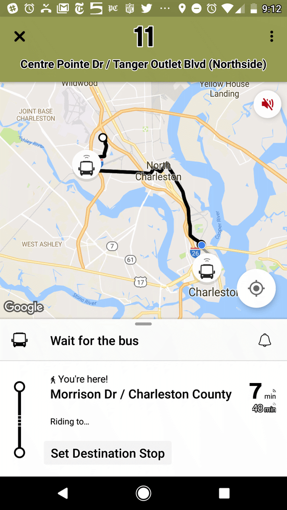
Download “Transit” and travel like a true Charlestonian.
Available in the App Store and on Google Play, “Transit” offers numerous features to help you easily navigate around Charleston.
Bus Route: See vehicle locations in real time, find nearby stops, and receive stop announcements.
Service Alerts: Keep on top of schedule changes, stop relocations and other unexpected surprises.
Favorites: Always take the same bus? Move it to the top of the list by adding it to your favorites.
Timetables: View the full schedule for a route and set alarms to remind you to leave.
Countdowns: Get real-time predictions based on data from the transit agency.
“Go”: Get step-by-step transit directions and notifications about when to leave for your trip and when to get off the bus.
Plan a trip!: Compare trips side by side with your preferred transport modes selected.