fbpx
Plan Your Trip

Sunday, Jan. 7: 10 a.m. Service Impacts

CARTA is resuming service, as possible, at 10 a.m. on Sunday, Jan. 7. Below are current service impacts, which are subject to change. Expect delays and possible early service suspension later in the day.

Route 10: Will be able to travel to HealthSouth and Trident Tech, in addition to all other stops.
Route 12: Will operate. Will not travel along Ashley Phosphate Road to Northwoods Mall. Buses will wait out time at the Festival Centre park-and-ride lot.
Route13/104: Will not able to go on Park Circle, Remount Road or N. Rhett. Buses will travel from Montague Avenue to Rivers Avenue to get to the Superstop.
Route 20: Will operate as normal.
Route 31: Will not go service Riverland Terrace. Driver will take Maybank Road to Riverland Drive. Spring Street t is also closed between Meeting Street and King Street. Drivers will go Meeting Street to Columbus Street to King to Spring and back on route.
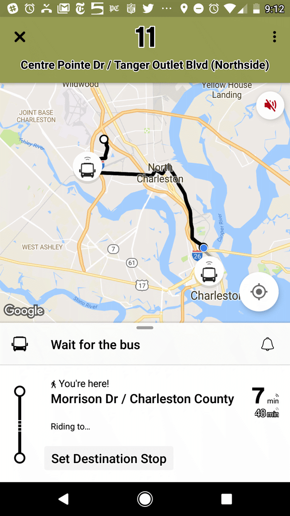
Route 11: Will run as normal. Buses will be traveling slower around North Carolina Avenue and Mary Street.
Route 30/40: Route 30 portion (West Ashley) will run as normal. Route 40 (Mount Pleasant) will not use the northbound frontage road. Buses will take Johnnie Dodds to Bowman Road, then back on route.
Route 32: Still unable to travel on Henry Tecklenburg. Buses will go to Castlewood as planned. Will take Savage to Orleans to Paul Cantrell/ Glenn McConnell. Will bypass the hospital.
Route 33: Will run as normal, but at slower speeds downtown due to ice patches.
Route 42: Cancelled.
Route 210: Will operate as normal.
Route 211: Will not go to Waterfront Park. Will stay on East Bay Street.
Route 213: Will operate as normal.
Mary Street Hub: Is open. Riders are urged to be very cautious walking in the area.

Saturday, Jan. 6 Noon Service Impacts

CARTA is resuming service, as possible, at noon on Saturday, Jan. 6. Below are current service impacts, which are subject to change. Expect delays.

Route 10: Patches of ice leading to Health South. Stop at Health South is a solid sheet of ice. Buses will proceed at 5-to-10 miles an hour.
Route 11:
Buses­­ take Rivers Avenue to Clement Street to Spruill Avenue.
Route 12:
Currently unable to run. Sheets of ice from Ashley Phosphate Road to Foxwood Drive (near Air Force base). Ashley Phosphate from Patriot Boulevard to Windsor Hill Boulevard  is also a sheet of ice.
Route 13: Reynolds Aveue. to McMillan Avenue. Buses will proceed at 5-to-10 miles an hour.
Route 20: Can travel straight along King Street to Broad Street.
Route 31: Riverland Terrace will not be serviced. Buses will take Maybank Highway to Riverland Drive.
Route 40: Ice in patches on Johnnie Dodds frontage roads. Buses will proceed at 5-to-10 miles an hour on frontage roads.
Route 42: Hungry Neck to the IOP connector includes sheets of ice. Buses will proceed at 5-to-10 miles be hours.
Route 104: Park Circle is a sheet of ice. Buses will proceed at 5-to-10 miles an hour.
Route 301: Henry Tecklenburg Drive leg is a no-go. 301 will take Savage Road back to Savannah Highway, to Paul Cantrell Boulevard (which becomes Glen McConnell).

DOWNTOWN
Service determinations are still being made due to hazardous conditions:

  • Mary Street Hub: Sheet of ice.
  • Meeting Street at Columbus Street is closed.
  • John Street is a sheet of ice.
  • Spring Street from King Street to Meeting Street is a sheet of ice.

ADDITIONAL NOTES:
As of now, the Route 13/104, Route 12, and Route 42 we will have to travel very slowly to perform route. Portions – or most of – these three routes remain sheets of ice.

Service to Begin at Noon on Friday, Jan. 5, 2018

CARTA will begin operations at noon on Jan. 5. That means buses will be at their scheduled locations at 12 p.m. There will be no morning Express service or any Tel-A-Ride appointments. Please be advised: delays and cancellations of service are possible as conditions dictate.

Rural bus service provider TriCounty Link will not run on Friday, Jan. 5.

Any further updates will be available via media updates and CARTA and TriCounty Link social media channels.

No service Thursday, Jan 4. 2018

Due to ongoing hazardous road conditions, CARTA will not operate any service on Thursday, Jan. 4. Authority officials will monitor the situation and provide updates here regarding service levels for Friday, Jan. 5

CARTA Operations Suspended 01/03/18

Due to deteriorating weather and roadway conditions, CARTA has suspended operations effective immediately and will resume service when the system can operate safely. Updates will be available via media updates and CARTA social media channels.

North Charleston Park & Ride Adjustment – Effective 11/06/17

Thank you all for your patience with our North Charleston Park and Ride.  We apologize for all the changes.

Starting Monday, November 6, 2017 all CARTA riders please return to parking in the front parking lot near Velocity.  The parking lot paving appears to have been completed for now, so we should have a little more flexibility with parking spaces, but please try to stay within the area shown below on the map.  

Buses will resume picking up at the front parking lot only on Monday 11/06/17.  

A couple of quick reminders:

  • Please be mindful of how you park.  Most spaces are now lined, so please take up only one space per vehicle so your fellow passengers will have the ability to park as well.
  • Do not park in the spaces around Velocity building (connected to the building around the complete exterior) or in the very front of Velocity (on Rivers Ave.)

Permanent Park and Ride Update: We are still waiting on the sale of the land we are purchasing located on the other side of Texas Roadhouse to be finalized.  At this time we do not have any additional updates or estimates when it will be completed.  Staff will provide updates on site at the parking lot and through email as we receive them.  Again thank you for your patience and understanding.  Please feel free to call or email us with any questions or concerns.

Rolling Forward: CARTA Now Features Real-Time “Transit” App

Accurate bus tracking, easy trip-planning and more

The Charleston Area Regional Transportation Authority (CARTA) today announced its partnership with Transit, the premier public transportation mobile app.

Riders will now be able to navigate the Charleston area with accurate real-time predictions, simple trip planning, step-by-step navigation, service disruption notifications, and departure and stop reminders – and it’s all presented in a clear, bold interface.

“This app is a key tool in the rider experience and is the first of several digital steps we’ll be taking this fall to make CARTA more appealing,” said CARTA Board of Directors Chairman Mike Seekings. “Better technology is helping us lay the foundation for long-term, successful public transportation in the Lowcountry.”

Transit is available for free download in the Google Play and the App Store. Read Transit 101 for tips and tricks on how to use the app.

For riders without smart phones or Internet service, CARTA also introduced new SMS texting and phone service. Customers can call or text (843) 202-4410 and provide the stop number of their choice, which can be found on signs at bus stops. An automated system will then relay the next two real-time arrivals for each route servicing the selected stop.

“We’re sensitive to the fact that not everyone has a smart phone and we want to provide as many options as possible for all of our riders,” Seekings said.

In the coming weeks, CARTA will also roll out a new website and an online payment system that will be connected to on-board fare boxes. The transit system, meanwhile, continues to collect data from recently installed Automatic Passenger Counters that it plans to use in the deployment of future service. New shelters and buses are planned in the months ahead, as well.

CARTA Now Offers Phone/Text Arrival Information

CARTA riders can now call or text an automated number to find out when their bus will arrive.

Simply call or text (843) 202-4410 and provide the bus stop number of choice. (Each stop is assigned a number which is posted bus stop signs or can be found online here.)

Callers will be given the next two arrivals for each route servicing the stop, while texters will receive a response text with the same information.

Plan Your Trip
Transit App

Download “Transit” and travel like a true Charlestonian.

Available in the App Store and on Google Play, “Transit” offers numerous features to help you easily navigate around Charleston.

Bus Route: See vehicle locations in real time, find nearby stops, and receive stop announcements.

Service Alerts: Keep on top of schedule changes, stop relocations and other unexpected surprises.

Favorites: Always take the same bus? Move it to the top of the list by adding it to your favorites.

Timetables: View the full schedule for a route and set alarms to remind you to leave.

Countdowns: Get real-time predictions based on data from the transit agency.

“Go”: Get step-by-step transit directions and notifications about when to leave for your trip and when to get off the bus.

Plan a trip!: Compare trips side by side with your preferred transport modes selected.

View Transit 101

Download TransitApp from Google Play Store
Download TransitApp from Apple Store
TransitApp